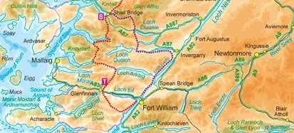
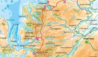
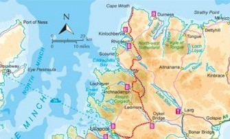
Journey of a lifetime
The road to Cape Wrath
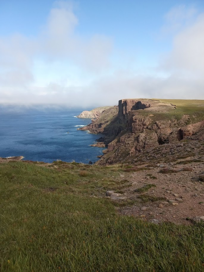
We stood looking out at the North Atlantic, with nothing but waves and rushing air between us and the North Pole. The ground dropped precipitously away from our feet, plunging several hundred feet into surging water that drifted in and out of view between wreaths of mist. There was no sound but the soft roar of the ocean and the eerie calls of seabirds that swooped and dived like small dragons around the mighty cliffs.
We had reached the end of the Cape Wrath Trail. 230 miles and 3 weeks of hard labour lay behind us, and now we had run out of land, right at the north-western edge of the British mainland. I hadn’t been sure what I would feel upon reaching the end of this daunting trek – relief? Exhaustion? Instead, I felt overcome with awe, and to my surprise, a sense of real sadness that the journey was over.
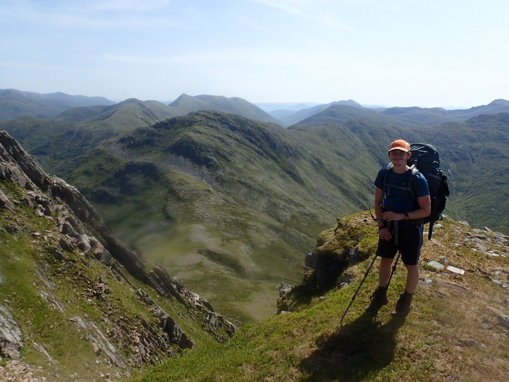
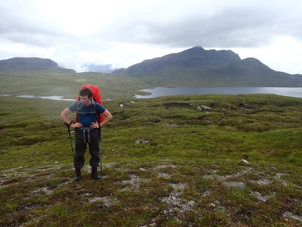
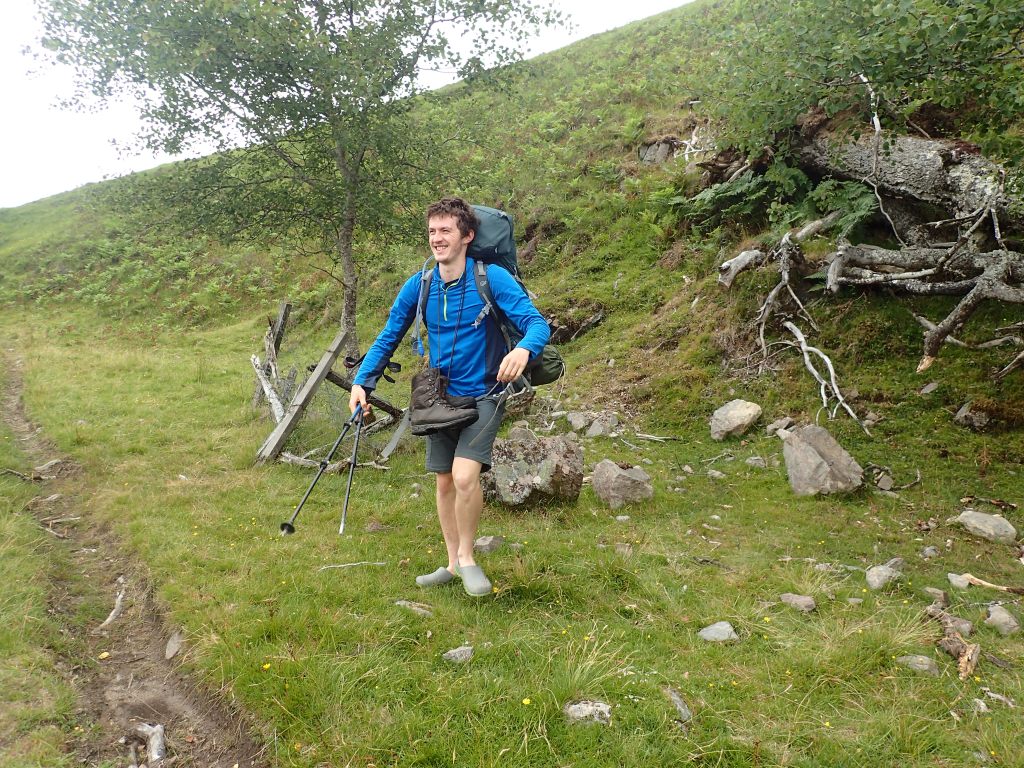
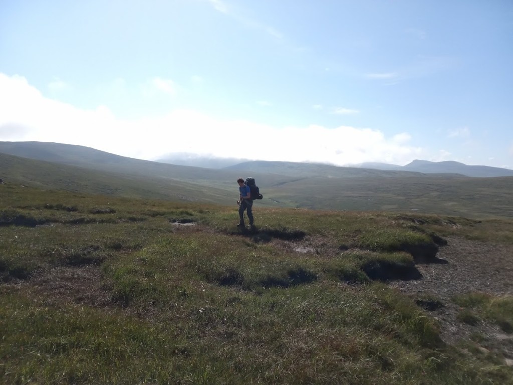
It certainly wasn’t always this way. The Trail had proved to be an emotional rollercoaster for both Chris and I, as well as an extreme physical challenge. We had traversed endless miles of pathless terrain, mountain passes and midge-ridden bogs, carrying up to 20kg on our backs and walking an average of 19km per day. There had been moments where we were close to giving up. Standing at last on the Cape, I felt immensely thankful that we hadn’t.
The following is the story of how Chris and I got ourselves from Fort William to Cape Wrath, and how the journey changed us both along the way.
Stage 1
Fort William to Shiel Bridge
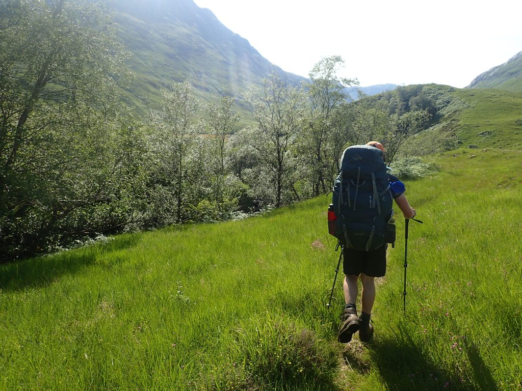
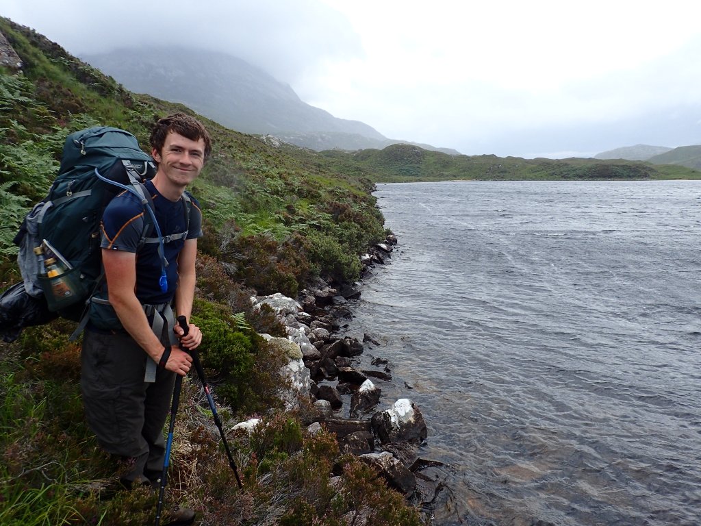
Our journey began on a drizzly Saturday afternoon in Fort William. After a frantic sprint along the harbour front to catch the last ferry, we clambered on board a rusted red boat which chugged out across the loch towards our starting point on the far side. This was the point of no return: a large body of choppy water now lay between us and our car. With no alternative but to start walking, we took our first steps on the Trail.
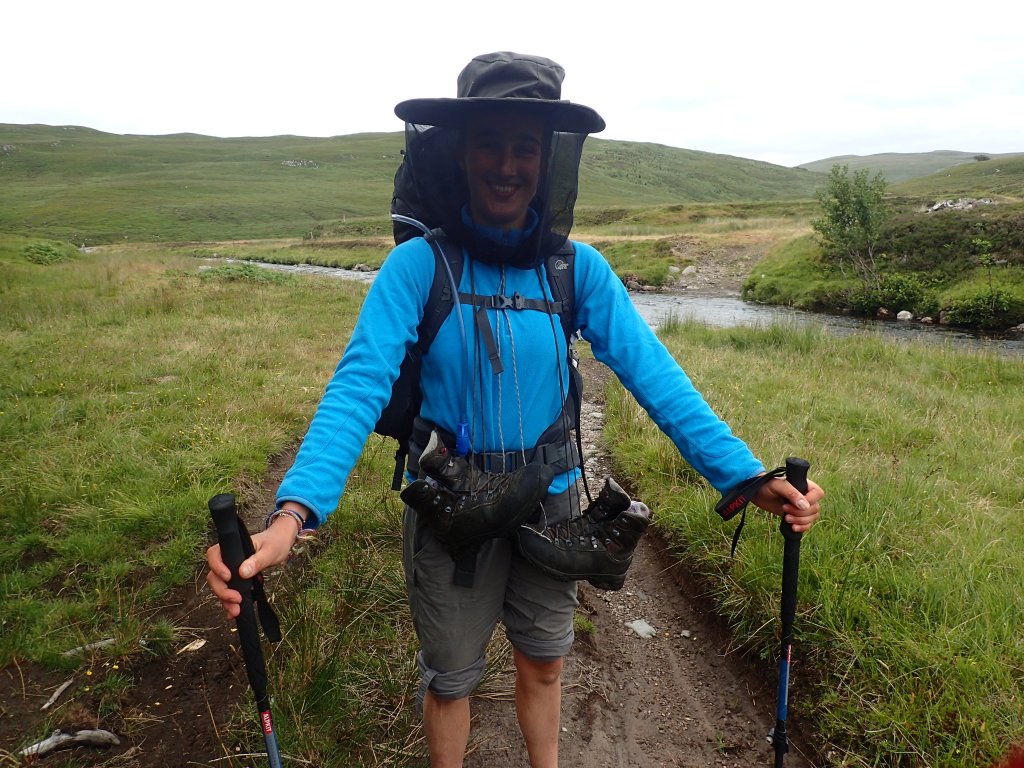
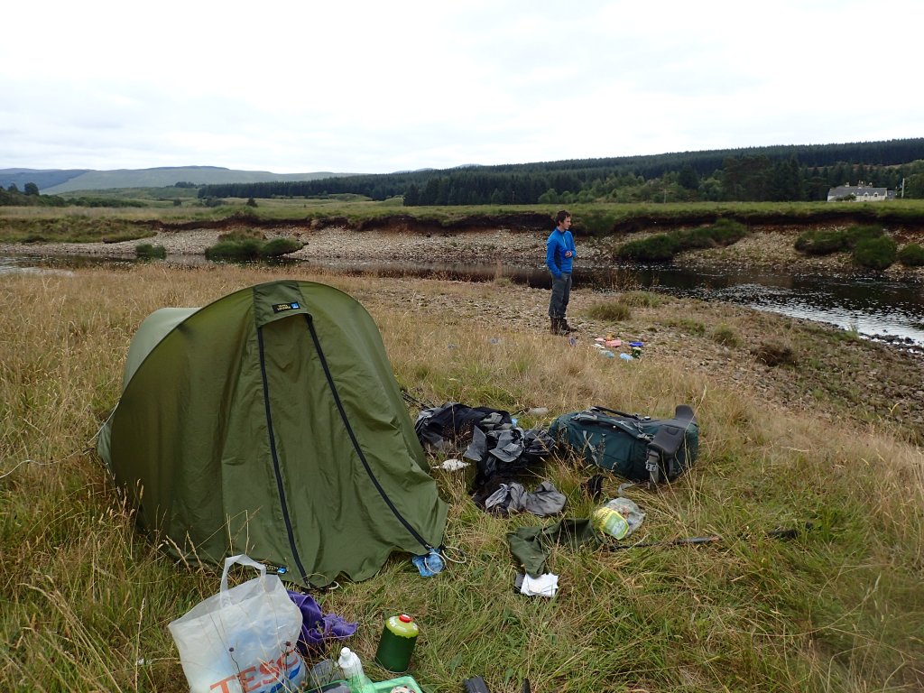
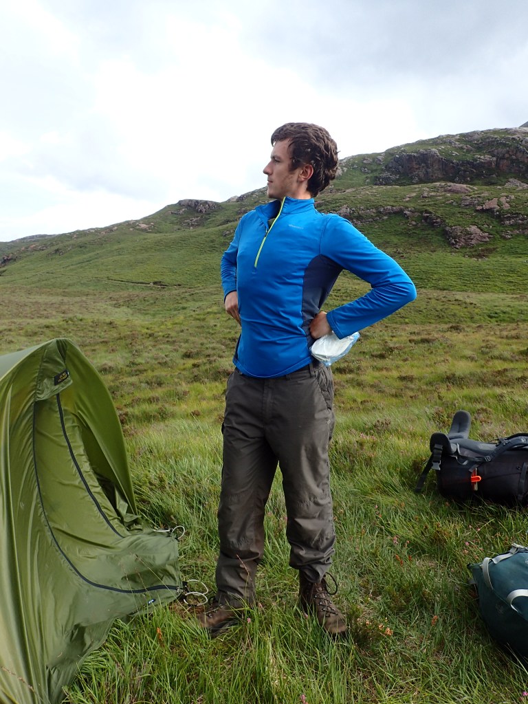
The first few days were, in a word, brutal. Unused to the weight on our shoulders and hips and the strain it placed on bones and joints, we quickly discovered that a large part of the challenge was learning to put up with almost constant pain. To make matters worse, on our very first night we were ambushed by swarms of midges which blizzarded into the tent through a small rip in the door we hadn’t previously known about. For those who have never encountered the Scottish midge, I can only describe them as a form of torture that I would not wish on my worst enemy.
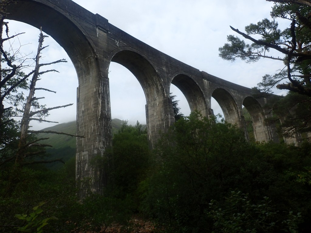
Making up for these physical discomforts, however, was the stunning scenery that surrounded us from day one. Our route curved gradually northwards through the lush green folds of Glen Cona, climbing up and over a pass before dropping into Glenfinnan – home to the famous viaduct that features in the Harry Potter films. It was here, at the end of a gruelling 27km day, that we arrived at our first bothy – the only bothy in Scotland that has electricity, its tweed-clad caretaker proudly informed us.
The July heatwave hit on our second day as we climbed another pass out of Glen Finnan and dropped into neighbouring Glen Dessary. Although the weather was beautiful, the heat made progress extremely hard-going. Before long we were each getting through 4 litres of water per day. The sunshine also brought hordes of ‘clegs’ – aggressive biting horseflies which leave furiously itchy welts the size of satsumas.
We quickly settled into a routine: start each day by slathering our skin with a disgusting mixture of suncream and insect repellent; walk for an hour; rest, eat and drink; repeat. By the end of each day we were so sticky and overheated that our first priority was to jump into the nearest body of water, be it loch, river or sea, to cool off. Our bottle of biodegradable ‘Wilderness Wash’ came into its own for scrubbing the sweat and grease from our skin, and washing the day’s socks and underwear so that it could dry off hanging from our packs the next day. After that, all remaining energy was devoted to cooking and devouring dinner, washing up in the nearest stream, and relaxing for a while before going to bed.
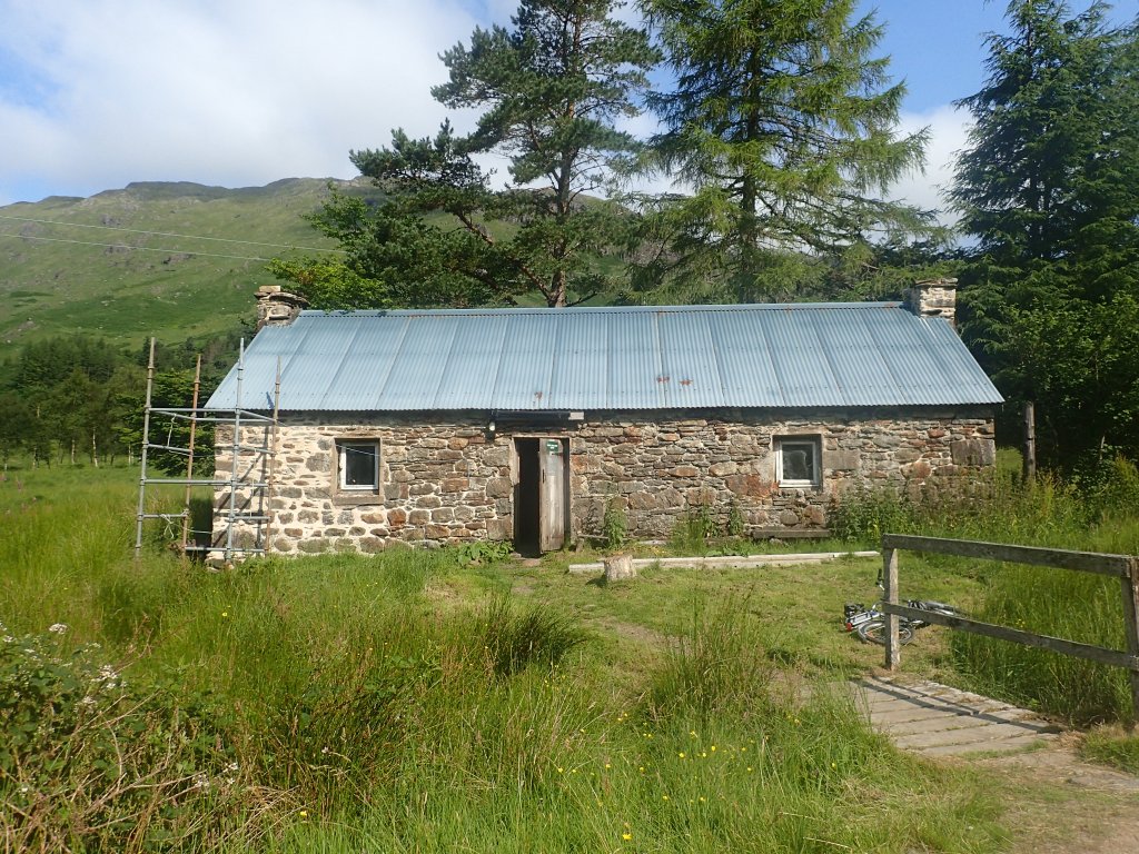
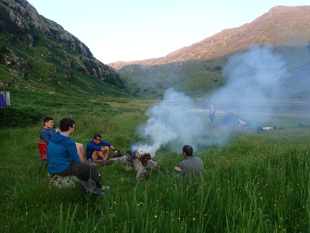
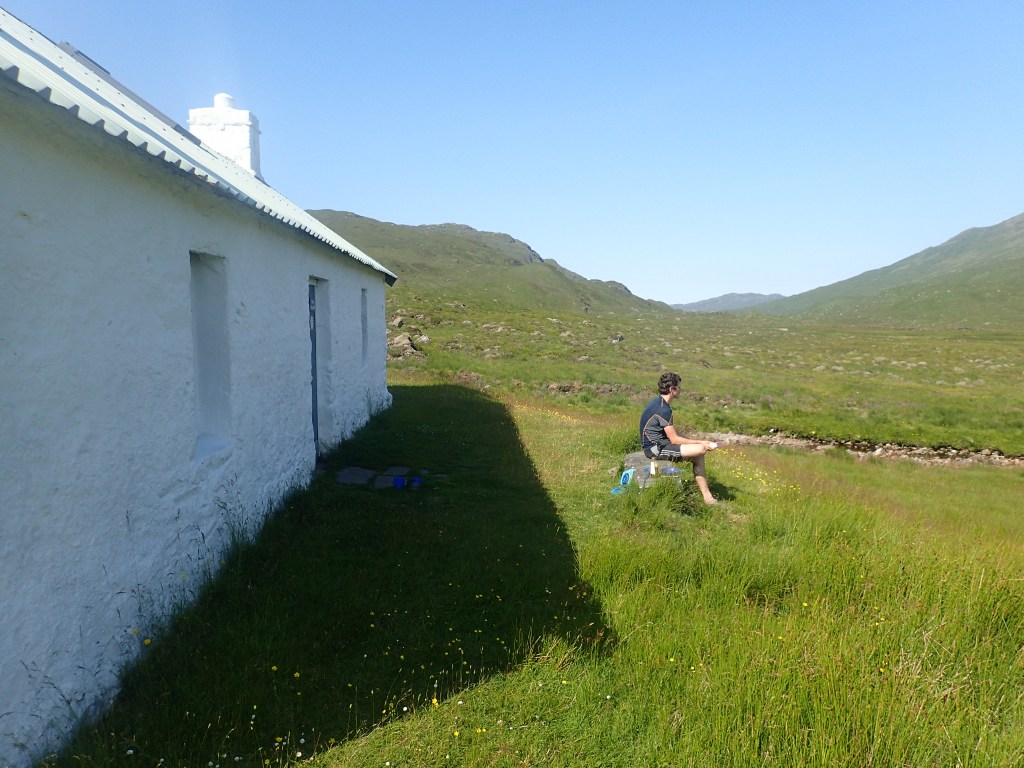
Bothies soon became our best friend. These simple stone shelters, once remote farmsteads or gamekeepers’ cottages, are scattered across Scotland’s hills and islands. Many are now maintained by the Mountain Bothy Association and are freely accessible to all, as long as visitors use them respectfully. Not only were the bothies cooler and more spacious than our tent, which turned into a mini greenhouse in the hot sun, but they provided a sacred refuge from the teeming hordes of midges that appeared each evening as soon as the sun dipped below the horizon.
Luckily, the first stage of the Trail allowed us to stay in a bothy nearly every night. After Glenfinnan, we reached A’Chuil – a beautiful bothy overlooking Glen Dessary, where we encounted five shirtless Scots from Aberdeen and their dog, Hector, who took an extreme dislike to Chris despite the Aberdonians’ assurances that ‘he’s very friendly, really!’ Hector’s vicious snarls suggested otherwise.
The following evening brought us to Sourlies bothy, magnificently located at the head of Loch Nevis, a long sealoch framed by towering mountains. Here we met a pair of young men from London who were also attempting the Cape Wrath Trail, albeit covering twice as much distance and consuming less than half as many calories as us each day. Unsurprisingly, they seemed even more knackered than we were. There was also an older couple from Lochaber who were old hands at bothying; after producing a seafood feast complete with glasses of red wine, they lit a roaring fire of dried seaweed around which all six of us gathered, talking long into the night and enjoying the chance connection with other humans in this wild and lonely place.
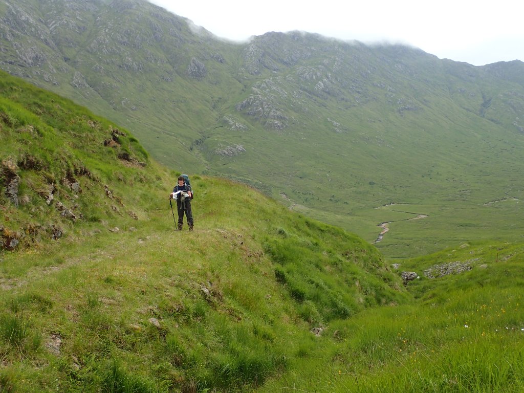
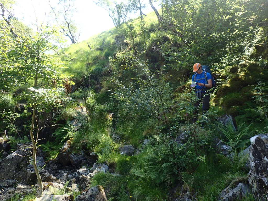
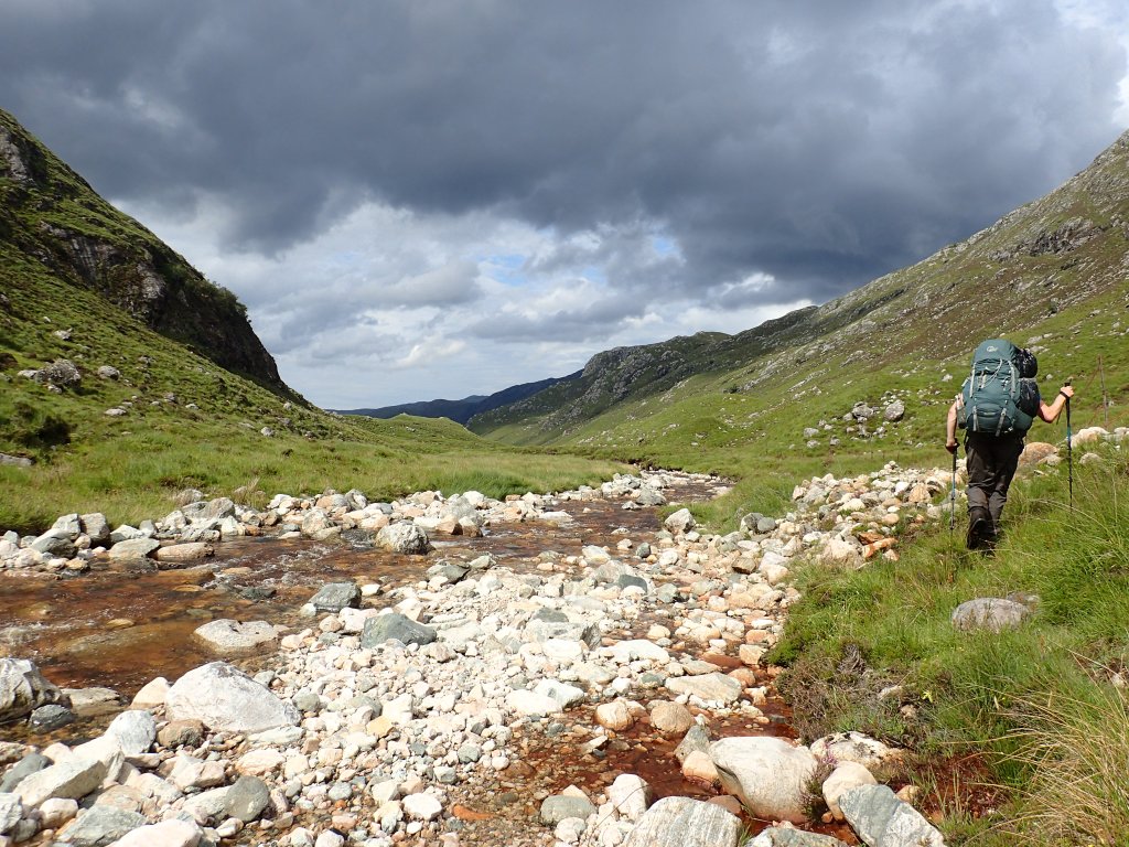
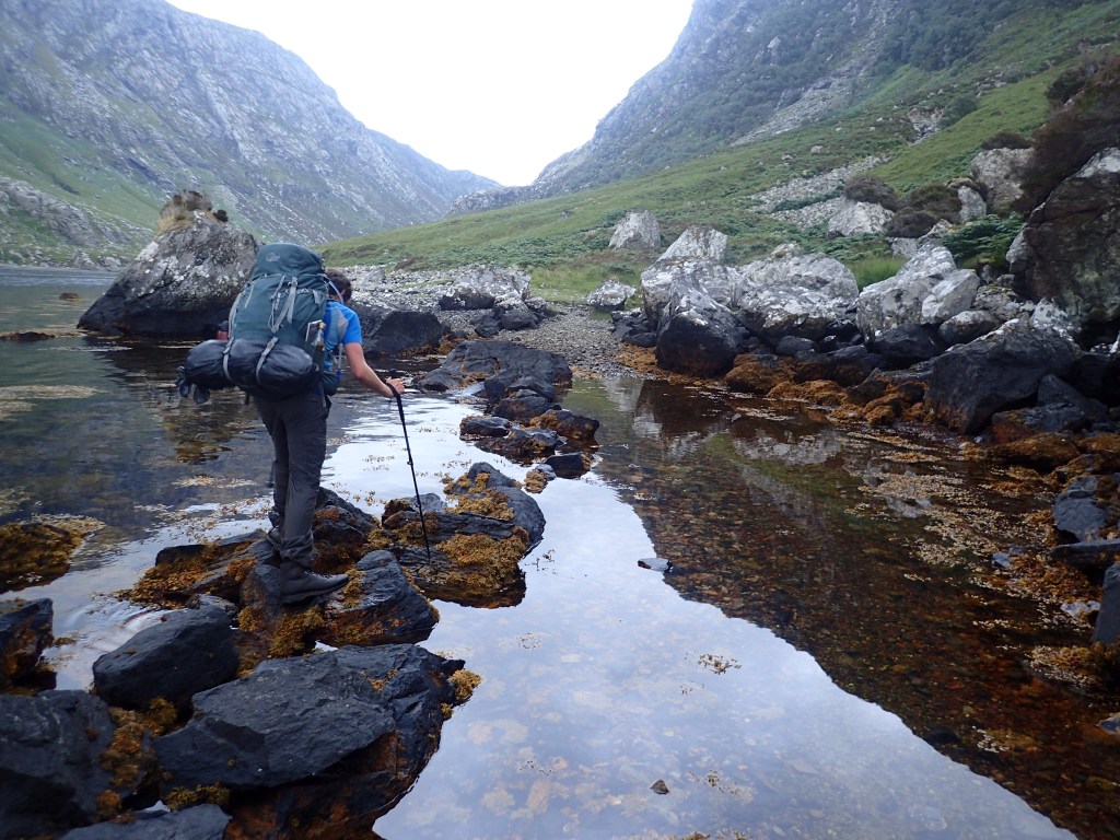
The next day dawned even hotter than the last. Leaving Sourlies and Loch Nevis behind, we headed inland, into what is aptly named ‘the Rough Bounds of Knoydart’. It soon became apparent why this is the case. Up until this point our route had been blessed with some form of path. However, heading into the depths of the Knoydart peninsula, we soon found ourselves stumbling through tussock, bog and boulder, while the sun beat down relentlessly overhead. It was in this rough wilderness that we first brought out the first aid kit, after Chris slashed his knee on a sharp tree stump. A little further on, the end of Chris’s walking pole became detached and vanished inexplicably into a bog. After spending twenty minutes digging up the bog with our toilet trowel, we were forced to admit defeat and soldier on.
It was something of a relief, after a long and sweaty ascent, to climb over a pass and drop down into the next fjord-like glen as evening descended. Isolated from roads, the small settlement at Barisdale lies at the edge of another winding sea loch, Loch Hourn, and is serviced only by boat. After dropping our bags at the ‘bothy’, which miraculously had a real flush toilet, we set off for a cooling dip in the sea. The tide was low, leaving a vast expanse of seaweed and saltmarsh to cross before reaching the water’s edge. It was a perfect Highland summer evening: the air was still and the sea like a mirror as the sun sank into the horizon, flooding the bay with golden light. We waded towards the sunset through silken water that never reached higher than our knees; every shell on the seabed was crystal clear, as if looking through glass. Finally we stopped, and stood bathed in light, until dusk crept over the land.
In that moment, every moment of pain and toil felt as if it had been worth it.
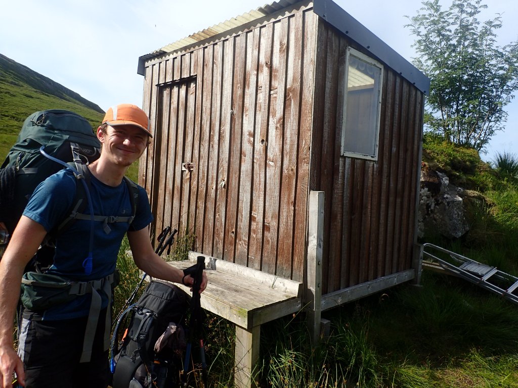
After a midgy night, we continued our journey, heading inland along the banks of Loch Hourn, which extends its long arm all the way to a small settlement at Kinloch Hourn – the first contact with a road in several days. En route, we met a kindly gentleman who provided us with some much-needed sustenance in the form of wine gums, and offered for us to leave our bag of rubbish under his car for him to take away when he returned. Upon reaching Kinloch Hourn, we identified his car (an unmistakeable champagne-coloured Jaguar) and deposited our rubbish, before rounding the end of the loch at last and ascending into the hills on the northern side. Feeling strong, we pushed on until we reached a tiny stalker’s hut on the banks of a shallow river high up in the Glen Shiel hills. As we had originally planned to camp at Kinloch Hourn, we were feeling smug, congratulating ourselves on biting off a chunk of tomorrow’s work despite the intense heat. So smug, in fact, that we cheerily decided that we could manage a detour from the main route in order to bag a Munro summit* tomorrow.
That night, however, we barely slept. The midges were vicious, somehow infiltrating our refuge in the the stalker’s hut. The tent was the only escape, thanks to a coil of incense burning at the entrance, but it was so hot inside that we poured with sweat even while lying still. To make matters worse, we had unwittingly pitched it on a slope, so that most of the night was spent dragging ourselves upright against the force of gravity. Tired and groggy, we set off up the Munro the next morning on what must have been the hottest day yet. By the time we reached the summit of Sgurr na Sgine at midday, we had already used up most of our water and energy for the day. After a back-breaking descent down a near-vertical boulder field, we reached a high pass between two mountains and wearily ate lunch. Watching an energetic young couple skip up the peak we’d just descended, agile as gazelles with only light daypacks on their backs, I couldn’t help but question why we were doing this to ourselves.
* Munro summit – a peak in Scotland that is higher than 3,000 ft above sea level.
Onwards, however, was the only option. After what seemed like an endless march, we finally reached civilisation at the Glen Shiel caravan site at 7pm, where happy holidaymakers were enjoying an evening dip in the river and drinking wine. Filthy, exhausted, and footsore, we decided to set aside our pride and order a taxi to the Air BnB we’d booked for the night. None were available, however, leaving us with no choice but to make the 4.5-mile trek along the road. By the time we finally arrived 1.5 hours later, I was nearly delirious from heat and exhaustion. Due to the lack of facilities in Glen Shiel, we’d posted a package to the BnB containing all our food for the next five days, but to our dismay, it hadn’t arrived. Having eventually determined that it had in fact been delivered to the BnB next door, we cooked up a batch of pasta on our camping stove on the bedroom floor. After enjoying possibly the most blissful shower I’ve ever had in my life and brief calls to our families to inform them we were still alive, we collapsed in bed, utterly spent.
Stage 2
Shiel Bridge to Ullapool
The next morning we awoke refreshed after a glorious night’s sleep, able to appreciate for the first time that we were already one third of the way through the trek. We devoured a delicious cooked breakfast prepared by our host, Adrian, who generously gave us a lift back along the road to the starting point of the next stage. The day’s route took us through searing heat to the Falls of Glomach (one of several waterfalls we encountered along the way which claimed to be the highest in Scotland) and up onto a high, boggy plateau that I can only describe as midge hell. Due to a relatively late start and long day, with 27km of distance and 900m of ascent, we didn’t reach the sanctuary of Maol Buidhe bothy until 9pm, by which point we were in a frenzy to escape the clouds of midges. The lone hillwalker who was already there tucked up in bed must have got quite a fright when we piled through the door with the desperation of those escaping from a burning building.
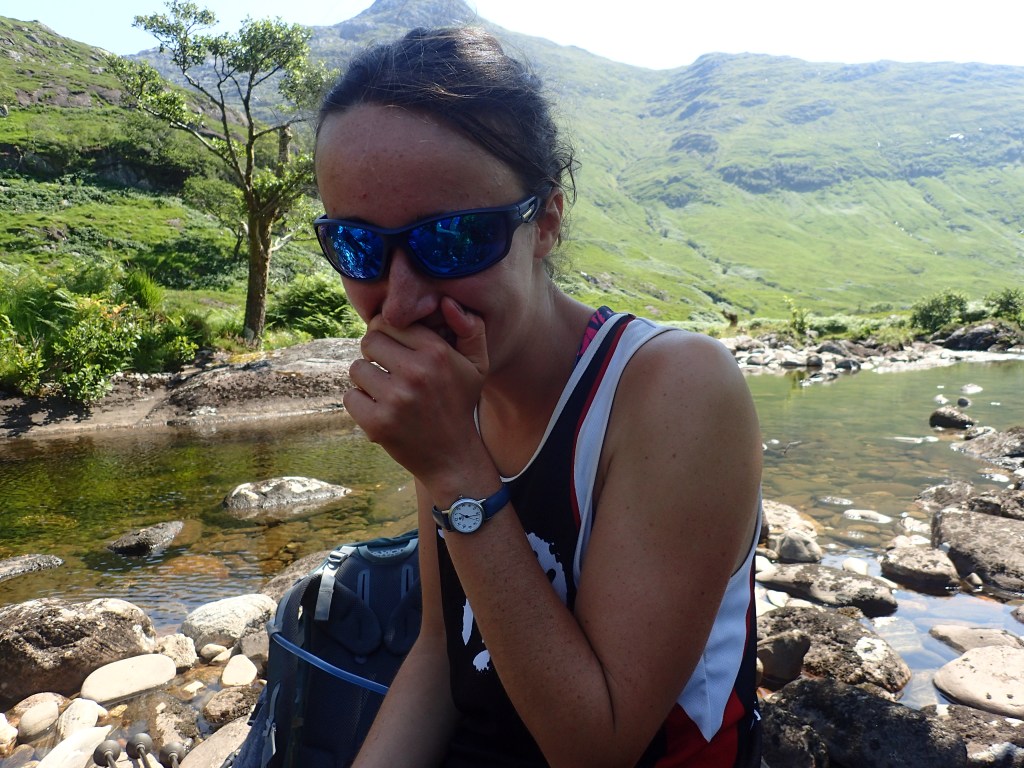
In the light of morning, however, with the midges gone to wherever they disappear to during the day, Maol Buidhe was a different world. Once home to a succession of gamekeeper families, and complete with its own ‘ceilidh hall’, it nestled peacefully amongst rippling emerald grasses, disturbed only by the cry of the curlew. As it was such a beautiful day, and the planned route relatively gentle, we decided to take some time out to clean up and refresh ourselves. A succession of late night arrivals had left us drained and short of clean clothes, due to a lack of time and energy to keep up with the laundry. After a taxing scramble through pathless bog, we reached a deserted loch where we spent a happy couple of hours washing ourselves and our clothes with gleeful abandon.
No sooner had we finished washing than a voice interrupted our peaceful sunbathing. Much to our surprise, a young woman appeared over the horizon, carrying a pack just as big and heavy as ours. It turned out that she had lost her phone in the bog, which unfortunately contained her debit card, her train tickets, and her GPS route. Did she have a map, we enquired? Yes, but she’d cut half of it off in order to save weight, and did not have the section covering the area we were in. (Chris and I were somewhat puzzled by her weight-saving priorities, as she’d chosen to carry a bag of carrots, brocolli, and aubergines as her main source of nutrition). Given that she had no means of communication and a mere £12.53 in cash, we decided to take her with us to Strathcarron, our destination for the day, which happened to have a hotel and a train station.
Our new friend seemed unperturbed by the situation she’d found herself in and cheerfully joined us for the rest of the day’s walk, telling us all about her passion as a yoga teacher and reiki healer. Chris and I were bemused, though deeply impressed, by her unfalteringly positive attitude, even when we were all getting exhausted and midge-bitten towards the end of the day. We were also baffled by her ability to keep going on nothing more than carrots and seeds, whilst we needed to shovel in vast quantities of peanut butter and flapjack just to keep ourselves upright. Finally descending into Strathcarron on a golden evening, the three of us managed to get last orders from Strathcarron Hotel and enjoyed a delicious meal while chatting to the assorted clientele. After paying for her meal, camping fee, and train tickets back to Inverness the next morning, we swapped contact details with our yoga friend and agreed to keep in touch. By the time we woke up in the campsite next morning, she’d gone, leaving a packet of oats, dried blueberries, and a feather outside our tent as a parting gift.
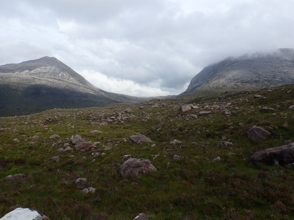
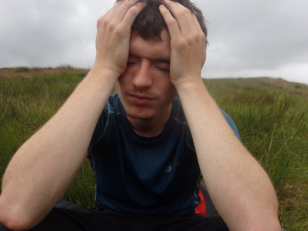
By this point, the unrelenting physical strain of the Trail was starting to take its toll. Chris had developed a muscular pain in his left shin, while I was concerned that I was developing stress fractures in my feet given the level of pain they were in. After seeking reassurance from Chris’s mother, a GP, we ploughed onwards, leaving Strathcarron and civilisation behind. Thankfully, a break in the weather was on its way at last, and the intense heat seemed to relent a little as we made our way up a glen towards the hallowed peaks of Torridon. I had heard so much about Beinn Eighe, Beinn Alligin, and Liathach that the famous summits had taken on an almost mythical status in my mind. However, nothing prepared me for the soaring drama of the vista that greeted us at the top of the pass. Gazing out towards the sweeping escarpments and jagged ridgelines of Torridon, I almost laughed out loud with joy.
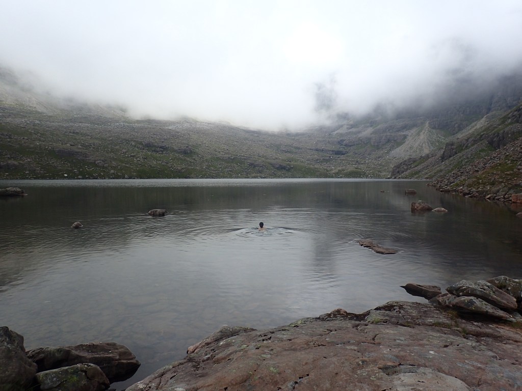
That night we stayed in the Ling Hut, a well-equipped bunkhouse that seemed palatial compared to the cramped quarters of our tent. By the following morning, the weather had definitely broken; the blue skies we’d become accustomed to were hidden in swirling grey cloud and the air was much cooler. It was a blessed relief to walk without being caked in suncream and insect repellent, as the cloudier weather had caused the clegs to disappear. Not only that, but the cooler climate had lent us a fresh burst of energy. Liberated from heatstroke and dehydration, we practically bounded up the foothills of Beinn Eighe, making a quicker pace than we’d managed on the entire Trail so far. By lunchtime we’d reached Lochan Coire Mhic Fhearchair, a beautiful lochan nestled in the bowl of the mountain, where I went for a spontaneous dip in its icy silver waters.
Having learned from our past mistakes, we resisted the temptation to finish climbing the magnificent mountain, and instead contoured around its flanks as recommended by the Cape Wrath Trail guidebook. However, this turned out to be extremely slow, tough work, scrambling over peat hags, boulders and huge glacial drumlins while using our poles to balance. Six miles of back-breaking work lay between us and the footpath that would take us down to the village of Kinlochewe, and to make matters worse, the building heat over the past ten days had finally collapsed – into a thunderstorm. With frightening suddenness, the weather closed in around us. As we struggled desperately towards the pass beyond which we knew Kinlochewe lay, a wall of mist began to roll up the glen behind us, accompanied by ominous rolls of thunder that grew louder by the minute. For four hours, we barely stopped to rest, but pushed relentlessly onwards, driven by primordial fear.
By the time we rounded the final spur of Beinn Eighe and reached easier ground in the form of a footpath, we were both frazzled and exhausted. The thunder had thankfully abated, but it was soon replaced by a torrential downpour. Tired and soggy, we trudged down to Kinlochewe, which soon turned out to be the unfriendliest village in Scotland. The hotel greeted us with a sign telling us that due to coronavirus restrictions, those without reservations must call reception. Standing in the pouring rain, we duly phoned reception, whilst the receptionist watched us suspiciously through the window and promptly told us that the hotel was full. The local bunkhouse was the same, leaving the campsite as our only option. It turned out to be more of a caravan park, with one tiny patch of grass reserved for tents. As only one person was allowed in reception at a time, I waited outside while Chris negotiated with the irritable man at the desk, who tried to tell us that the campsite was full until his wife corrected him. Grudgingly, he allowed us to stay, while snapping at his wife not to bother showing us around. She, however, seemed to take pity on us, and showed us where we could pitch our tent as well as the shower block and drying room. As the rain had not abated and the midges were coming out in their billions, we spent the evening taking refuge in the drying room with the site’s only other tent occupants, a couple from Cheshire who were cycling the North Coast 500.
Chris’s shin pain, forgotten about in our haste to escape the thunderstorm, had developed to the point where he was unsure if he would be able to continue on the Trail. However, after a recommendation from the female cyclist to apply ice (in the absence of ice, we applied a hydration bladder full of cold water), the pain miraculously cleared up. Unfortunately, the same could not be said of the rain, which continued all night and well into the following morning. Luckily the drying room had been our saviour, and all of our gear apart from the tent was beautifully crisp and dry. Just as the rain eased off mid-morning, we headed out into a landscape that was almost unrecognisable, altered drastically by 18 hours of continuous rain. Gone were the cracked bogs, sun-baked trails and dried-out riverbeds. Instead, we were surrounded by dripping vegetation and roaring water, with all the burns in full spate.
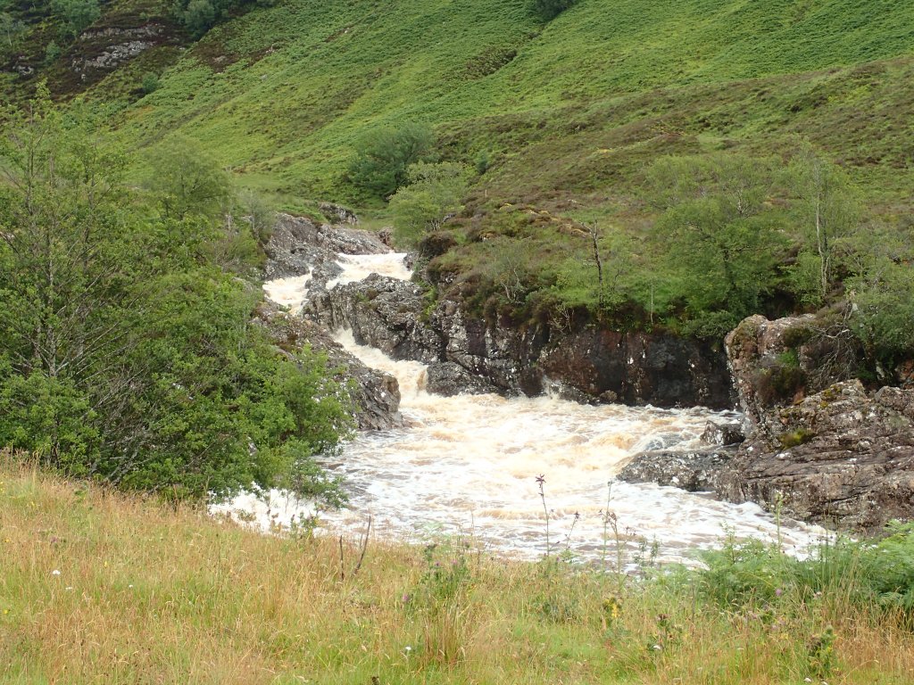
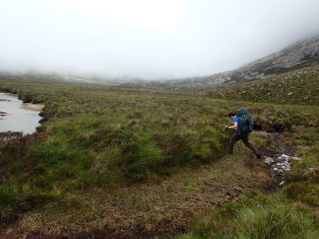
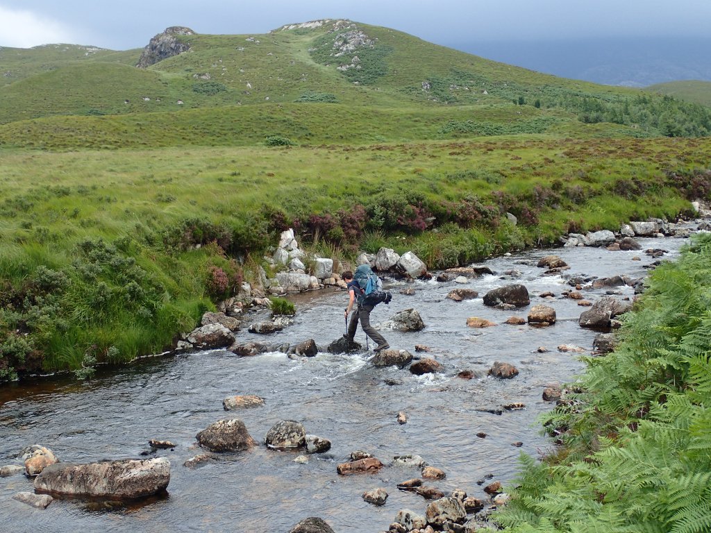
At least dehydration was no longer a concern, although we did finally start to encounter some of the challenging river crossings for which the Trail is notorious. It wasn’t long before both of us had soggy feet as we left the well-paved stalker’s paths near Kinlochewe and ascended into the legendary Fisherfield Wilderness, home to Scotland’s remotest Munros. Plenty of now-familiar pathless bog welcomed us into the vast landscape as we roamed over pass and glen, alone except for a vast Hercules aircraft that roared up the Strath na Sealga, its wingtips almost touching the steep sides of the glen.
Weariness weighed heavily on us as we marched the final few miles to the famous Shenavall bothy, nestled at the foot of the mighty An Teallach, where my father first fell in love with Scottish hillwalking at the age of 16. The mountains themselves were hidden in wreaths of mist, but their looming presence was almost tangible as we pushed through dripping bracken to refill water in the surging burn near the bothy. As darkness fell, two headtorches appeared through the gloom and we were joined by a pair of hillwalkers who chatted to us while we devoured our freeze-dried dinners. They were planning to tackle the Fisherfield Horseshoe the next day, using Shenavall as a base in order to access the remote peaks. Bidding them goodnight, we hung up our soggy gear on the various nails and hooks dotted around the bothy before curling up to sleep.
The next day dawned just as damp and misty as the last; our hillwalking friends had long since departed into the mountains on their quest to conquer the Fisherfield Munros. It seemed to take us a long time to pack up and get ready, but eventually we set off into the rain once more, in boots that were still saturated from the day before. It had been nearly a week since our last civilisation break at Shiel Bridge, and we’d been walking continuously for nearly 11 days. Fatigue was starting to set in as we skirted the flanks of An Teallach and pushed wearily on towards Ullapool and the end of Stage 2.
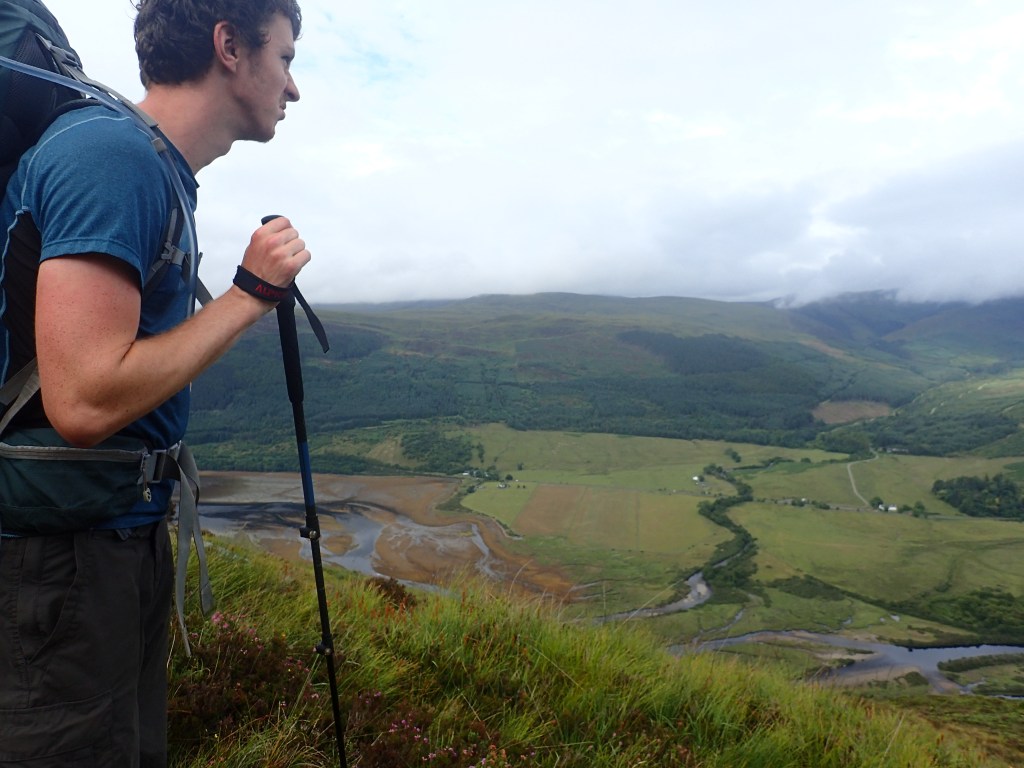
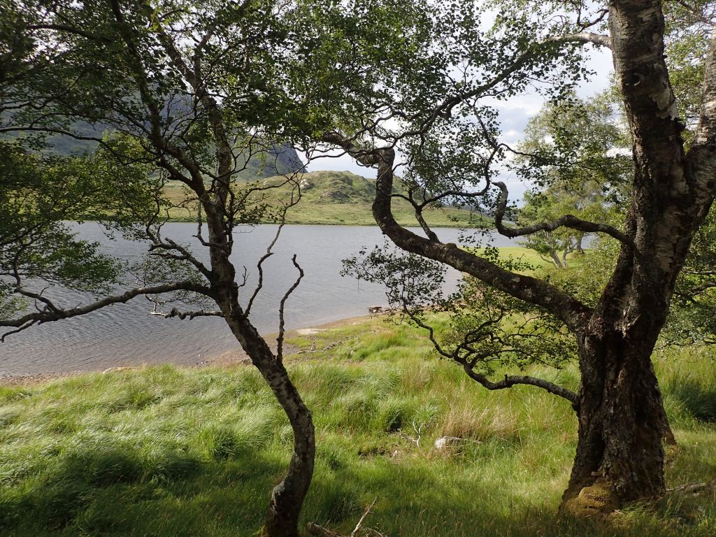
Finally, after crossing a seemingly endless boggy plateau, we found ourselves at the top of a steep slope, looking down at Loch Broom as it carved its way inland. Out west towards the open ocean, the town of Ullapool nestled on the sea loch’s northern shore, while directly below us, the loch petered out into salt marsh and lush, fertile farmland, around which were clustered the hamlets of Inverlael and Letters. Somewhere down there, we knew, was shelter, warmth, and food. Gazing out across the achingly familiar landscape, a place I’d returned to again and again as a child, and the place we’d set off from to begin the Cape Wrath Trail, it felt almost like a homecoming; as if we’d already come full circle.
After a joint-shuddering descent, we finally staggered to the front door of Clachan Farmhouse BnB, where we were warmly greeted by Marie, our host for the night. It turned out that due to her home’s location right on the Trail, she was quite used to dealing with exhausted, wet walkers. Much to our embarrassment and eternal gratitude, she offered us newspaper to stuff inside our filthy, bog-saturated boots, put all of our stinking clothes straight into the washing machine, and whipped up a hearty meal of fish and chips. Gloriously clean after our showers and digesting the delicious meal in Marie’s cosy sitting room, we gazed out at the rain beyond the window and wondered if perhaps the time had come to call it a day.
We’d given it our best shot, and to have made it as far as Ullapool felt like an achievement in itself. We’d already covered at least 150 miles, most of it during a heatwave, and Ullapool was a natural break in the Trail, with good public transport links to Inverness and home. But if we pushed on into the remote country beyond Ullapool, there would be limited opportunities to bail out. We were uncomfortably aware that the heavy rain over the last few days would allow the midges, held back by the uncharacteristic dry spell, to come out in full flush. Another 9 days of walking lay between us and the Cape, including some of the remotest terrain on the Trail, and with bothies few and far between, we’d have little respite from the midges and the weather. Not to mention the fact that I was often in crippling pain, with both my feet and my shoulder causing near-constant discomfort. Surely, we thought, it would be better to recognise when enough was enough, and come back to finish what we’d started another time, rather than driving on regardless into more misery.
Refreshed and clad in freshly laundered clothes, we were picked up from Marie’s BnB the following morning by my parents’ old friends Johnny and Bex, who had retired to Letters a few years ago. Our decision to plan a rest day in Letters proved extremely fortuitous, as we soaked up endless cups of tea in Johnny and Bex’s kitchen and roared with laughter over our various exploits thus far. Johnny took us across Loch Broom to Ullapool in his boat, which proved a bumpy but highly enjoyable trip, allowing us to stock up on essential supplies such as more Wilderness Wash, anti-midge incense coils, and water purification tablets (just in case we changed our minds). Somehow, despite our sensible musings the night before, we knew deep down that it wasn’t over yet.
The rest of the day was spent researching ways to make the rest of the trip more manageable, including booking another hotel towards the end of the Trail, and ringing up numerous confused employees at the Ministry of Defence to check whether we could cross the military training range at Cape Wrath without getting blown up. We also split in two the vast 9-day food parcel we’d posted to Marie’s house, with Johnny kindly offering to drive half of it to a hotel located halfway through the final stage. This meant that the weight we’d be carrying for the next few days would be massively reduced.
By the evening, Chris and I were fully resolved: we were going to carry on. We had come so far already; so much time, effort, and money had gone into planning the trip, and it meant a great deal to both of us, in different ways. For me, it had been a life goal for years, and to give up now would mean admitting defeat, confirming the creeping self-doubts that had niggled in my mind during the dark days of the pandemic. I wanted to believe that I could do this; to prove that I was still capable of adventure, of physical challenge, of making plans and seeing them through to the end. We’d come too far to turn back now.
Stage 3
Ullapool to Cape Wrath
The rest day with Johnny and Bex proved to be the saving grace of the whole expedition. The brief respite from the Trail had given us the chance to rest, reflect, and renew our motivations for taking on the challenge. Emerging bright-eyed and bushy-tailed after a good night’s sleep and a hearty breakfast with our friends, we set off from where Johnny dropped us off in Ullapool with renewed determination to make it all the way to the Cape.
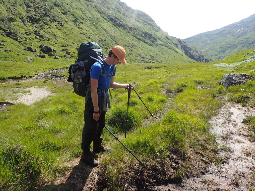
Compared to the endless steep ascents and descents of Stages 1 and 2, the first few days of Stage 3 were a walk in the park, crossing gently undulating moorland to Oykel Bridge before following the lush green banks of the River Oykel all the way to its source. Cooler temperatures, easier terrain and shorter planned days meant that we made rapid progress, with plenty of time to relax and revive in the evenings, while cool, breezy weather meant that the midges were mercifully absent (most of the time). On the first day, I realised that tying my boots less tightly meant that my feet were able to expand over the course of the day, drastically reducing the pain they were in. Why I didn’t think of this two weeks earlier, no one will ever know.
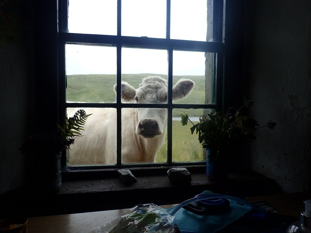
The first evening brought us to Knockdamph bothy, where we enjoyed a bracing dip in the nearby loch and spent the evening reading several years’ worth of mildewed Mountain Bothy Association newsletters. This was to distract us from the herd of cows that had surrounded the bothy and appeared to be attempting to knock it down, judging by the loud thuds and scraping sounds that surrounded us on all sides. Luckily they’d dispersed by the morning, allowing us to carry on to Oykel Bridge in peace.
The route to Oykel Bridge involved the first (and last) river crossing that necessitated swapping walking boots for our trusty Crocs in order to wade across. Pressing on past the small hamlet of Oykel Bridge, we camped in a meadow on the banks of the River Oykel, which is known as one of the best salmon fishing rivers in Scotland. Sure enough, we saw several salmon leaping out of the peat-dark water mere feet away while we washed up in the shallows. The next morning, we spoke to a well-to-do elderly couple who were out for a spot of fishing and informed us that Prince Charles had been staying at the lodge across the river just yesterday.
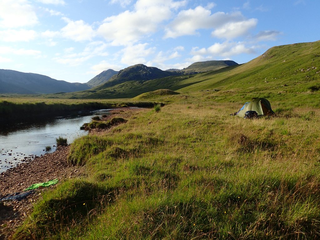
Sure enough, as we made our way further up the beautiful river, we encountered many more well-off country folk, all driving pristine Land Rovers along the rough 4×4 track and clad from head to toe in tweed. However, the further up we went the quieter our route became, taking us through peaceful plantation forest and opening out into Loch Ailsh, its banks swathed in clouds of purple willowherb. Skirting the loch, we continued into the upper reaches of the River Oykel, ascending once more towards the intimidating bulk of two Munros we’d climbed earlier that summer: Ben More Assynt and Conival. As we made our way into the remote glen, the clouds lifted to reveal a glorious summer evening. Pitching our tent in a sunny meadow in this high haven, it felt as if we’d briefly arrived in heaven.
Unfortunately, the idyllic scene was spoiled somewhat by the rapid intrusion of some particularly ravenous midges. The only escape was up to our necks in the river, where we remained until cold drove us out onto the bank, flapping and squealing like frenzied beasts to avoid the hordes of insects. Retreating to the tent, I prepared and ate dinner (tuna and couscous, which we’d eaten every other night for the past two weeks) while Chris, unable to stomach this concoction any longer, snacked on nuts instead. As the sun set, however, a cool breeze rippled around the tent, blowing the midges away and allowing us to emerge into a shadowy dusk, clasped between sun-tipped ridges on all sides.
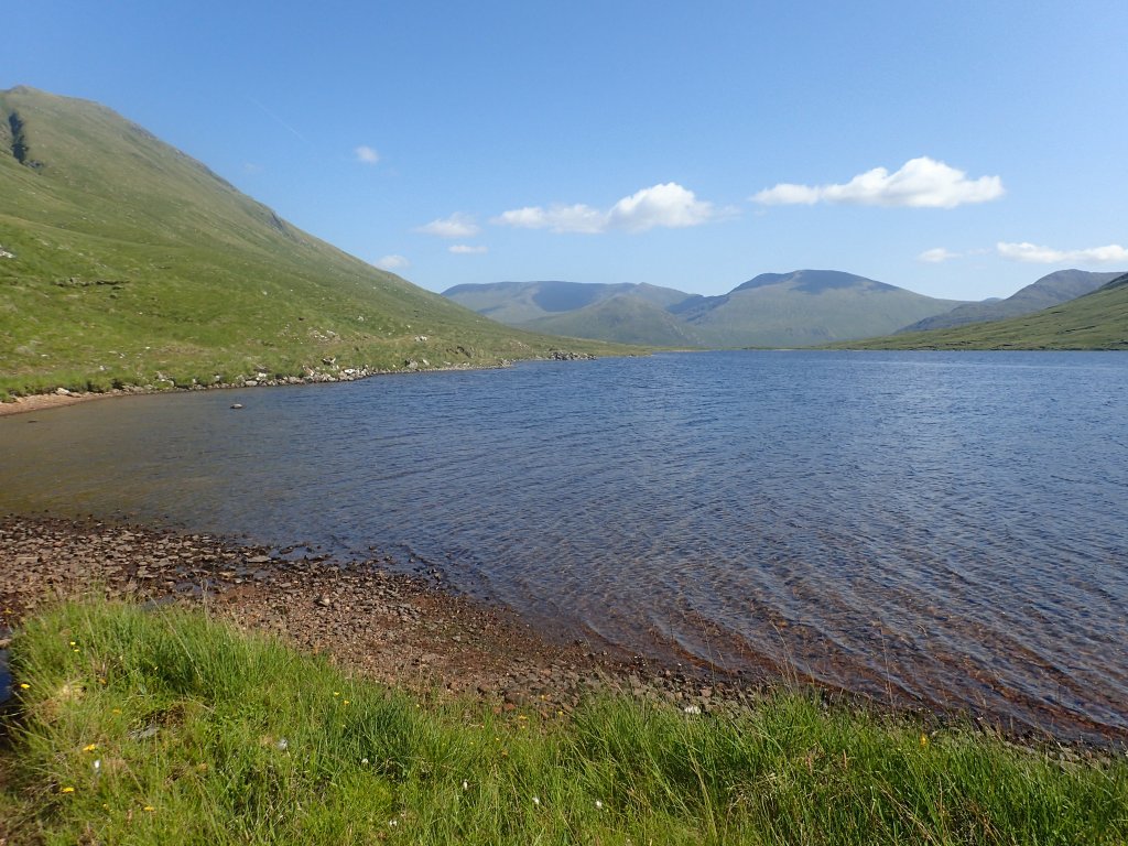
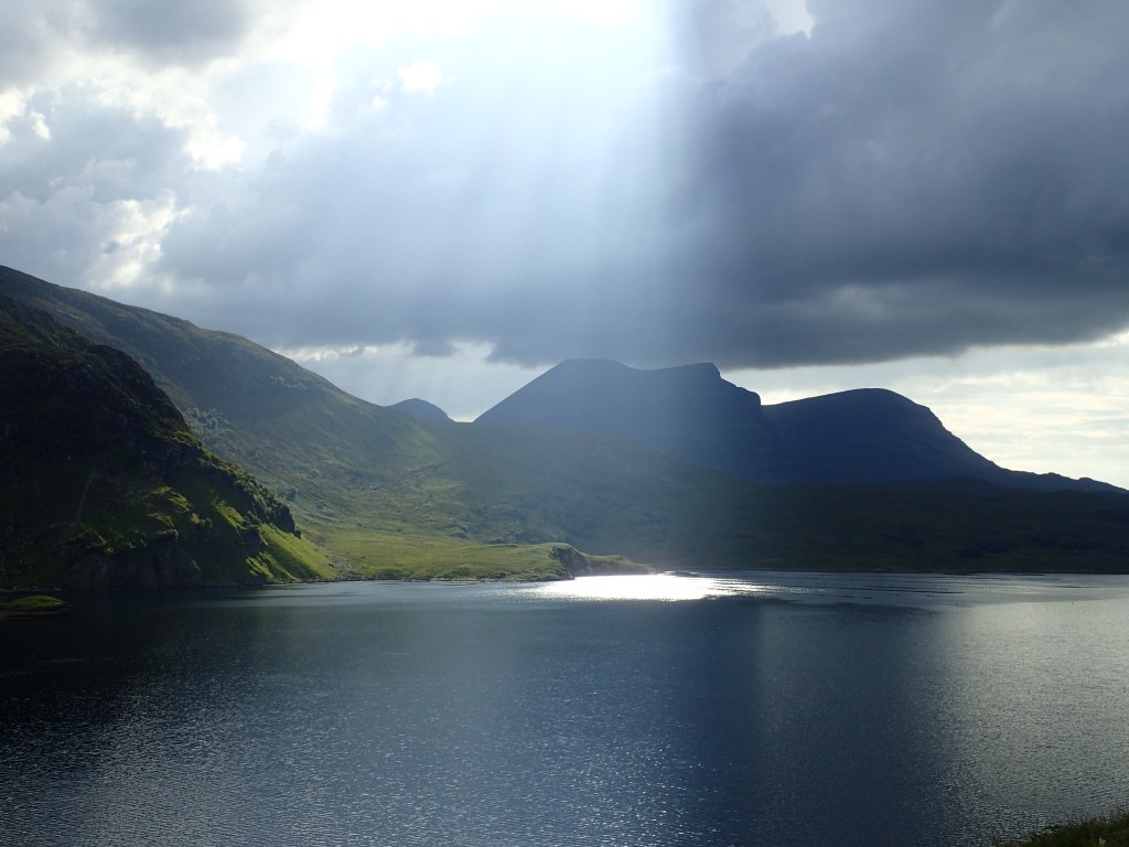
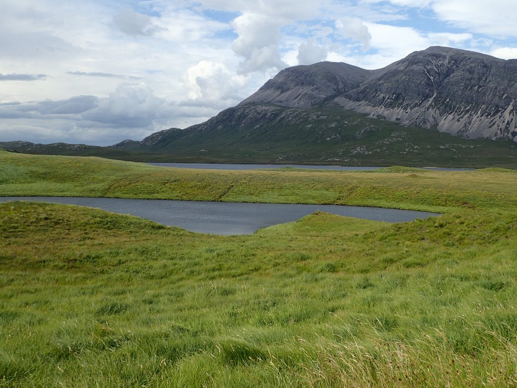
Waking to a grey, humid morning, we continued under the walls of Ben More Assynt to the head of the glen, ascending through intermittent rain showers over the shoulder of its neighbour Conival. As we topped the pass, a dramatic vista opened out below. The rugged moorland of Assynt stretched as far as the eye could see, rumpled with outcrops of Lewisian gneiss and threaded with bright flashes of lochan, while Loch Assynt carved its way through the landscape under the towering walls of Quinag.
Descending towards Inchnadamph, we found ourselves walking alongside another couple, who chatted with us all the way down to the village. They seemed somewhat concerned for our welfare, offering to give us a lift to Lochinver to pick up supplies, but we knew that the package Johnny had dropped off for us was waiting just a few miles away. Sure enough, it was safely tucked away in a cow shed adjoining the hotel at Inchnadamph. We made the most of the nearby picnic benches to cook an early dinner and dispose of our rubbish, before setting off again into the hills north of Inchnadamph. The steep ascent felt particularly gruelling after a long day, with full bellies and new weight in our packs, but it was worth it to reach a high wild camp overlooking the rocky wilderness of Sutherland. Facing west, we watched the light slowly sink over the familiar outlines of Suilven and Canisp, two of our most beloved hills.
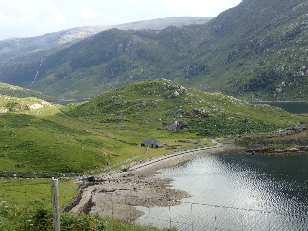
The next day proved to be one of the most taxing yet stunning days of the whole trip. We packed up camp in rain that soon eased, revealing a fresh, blustery day with sudden bursts of sunlight. Climbing into yet another high pass, we found ourselves facing an extraordinary view of steep rocky outcrops and cliffs rolling away into the distance, pierced by the Y-shaped arms of Loch a’ Chàirn Bhàin. Each fork penetrated deep inland and was tipped with a remote bothy. The most northerly of these, Glendhu, was our destination for the day.
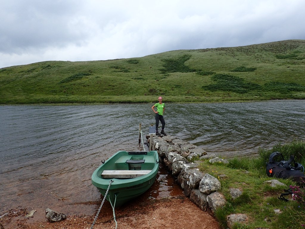
Our route wound through this uninhabited landscape, skirting lochans and scrambling along near-vertical slopes, surrounded by rushing water and lush vegetation. Dropping into a steep glen, we passed Eas a’ Chual Aluinn Waterfall (which is actually the highest waterfall not only in Scotland, but in all of Britain) and thrashed through thick vegetation to reach Glencoul Bothy at the head of the southerly fork in the loch. Already tired out after our efforts so far, we spent a happy couple of hours at the bothy, brewing tea on the stove and resting in soft sunshine. The bothy was in fact a cottage tacked onto the gable end of a magnificent derelict house, which stood facing up the loch in the shade of a softly rustling birch tree. It had clearly once been a grand place, with electricity and running water, despite being isolated from roads and accessible only by boat. Reading accounts in the bothy of the families who had lived here as recently as the 1950s, it was hard not to be touched by the peaceful atmosphere of the place, and the sense that people had been happy here in times gone by.
Dragging ourselves away from the peace of Glencoul, we followed a rough track ascending over the ridgeline that jutted out into the loch like the prow of a ship, separating the southern and northern forks. Quinag loomed ominously above sparkling waters on the far side of the loch. Out to the west, the Atlantic was illuminated by dazzling evening light, even as silver veils of rain showers passed over the face of the mountains. As we topped the ridge and dropped down its far side towards the northern fork of the loch, the track became increasingly rough until we were clawing our way through thigh-deep heather and scrambling over slippery boulders. Finally reaching the shore, which was strewn with giant boulders as big as houses that had crashed from the cliffs above, we staggered the final mile to Glendhu bothy.
After several nights of wild camping and a long, tiring day, it was something of a relief to reach the relative comfort of the bothy. Following a midge-frenzied wash in the nearby stream, we hung our sodden tent from the rafters to dry off, and fell asleep almost immediately under the sloped wooden ceiling.
The next morning took us along the northern shore of the loch before ascending once more into rugged hills to the north. Halfway up a well-built 4×4 track, we encountered a solitary digger, occupied by a man who was fast asleep. Startled by our approach, he quickly sprang into action, with the sheepish look of a man who had been caught napping at work. Not wanting to embarrass him any further, we carried on until we reached the high point for the day: a ruined sheiling overlooking the vast landscape of northern Sutherland, where the skyline is dominated by the summits of Foinaven, Arkle, and Ben Stack. Dropping down to the hamlet of Achfary, we crossed the main road and picked up a narrow single track road lined with knarled birch trees that curved around the shores of Loch Stack. It was a warm, sleepy afternoon, with the birches rustling in a soft breeze that stirred the surface of the loch and caused the lush grasses surrounding it to ripple like an emerald ocean.
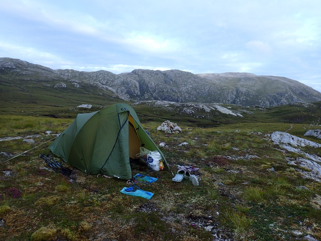
As we rounded the far eastern shores of Loch Stack beneath the steep flanks of Foinaven, the sky turned grey and menacing, and we found ourselves in the middle of a vast bog. Feeling rather like Samwise and Frodo being led across the Dead Marshes by Gollum (replaced, in this case, by the sadistic author of our guidebook), we leaped from island to island of firm ground amidst the expanse of swamp. This wavering path resulted in our pace dropping to less than 1 mile per hour, especially as the marshes were eventually replaced by swathes of waist-deep heather. After two hours of bushwhacking, we finally emerged to a stalker’s path, where we decided to pitch camp for the night.
All night long, the tent flapped in strong winds which created a blissfully midge-free environment. They did, however, make packing up the next morning rather challenging. Never one to give in easily, Chris rose to the challenge with an innovative solution to keep the tent from blowing away: stuffing it up our shirts.
Antics over, we continued the journey along a narrow deer path which followed a chain of lochans north-west towards the settlement of Rhiconich. Foinaven and Arkle brooded under banks of dark cloud and the wind whipped the lochs into white waves, but nothing dampened our joy at being out in this wild environment, not even a challenging river crossing which nearly sent Chris and his gear into the ice-cold water. Soon, however, signs of civilisation began to appear in the form of a fishing hut complete with jetty and rowboat, and a rapidly improving path. In no time at all we had reached Rhiconich, which consists entirely of a hotel and a public toilet, located right on the famous North Coast 500 driving route.
The last leg of the day was a 5-mile trudge along the road to Kinlochbervie, the most northwesterly harbour in Scotland. It felt distinctly sub-Arctic with its concrete fish-processing plant and low buildings scattered at random across the rugged landscape. We checked into the hotel, which felt like a time capsule from the 1970s with its interior décor reminiscent of Fawlty Towers. After devouring the biscuits in our hotel room, I crashed out for a 3-hour nap while heavy rain lashed the windows. Although it was cosy to be warm and dry and sheltered from the weather, we both felt a little wistful; we had become so used to living freely outdoors that the hotel seemed like almost excessive luxury.
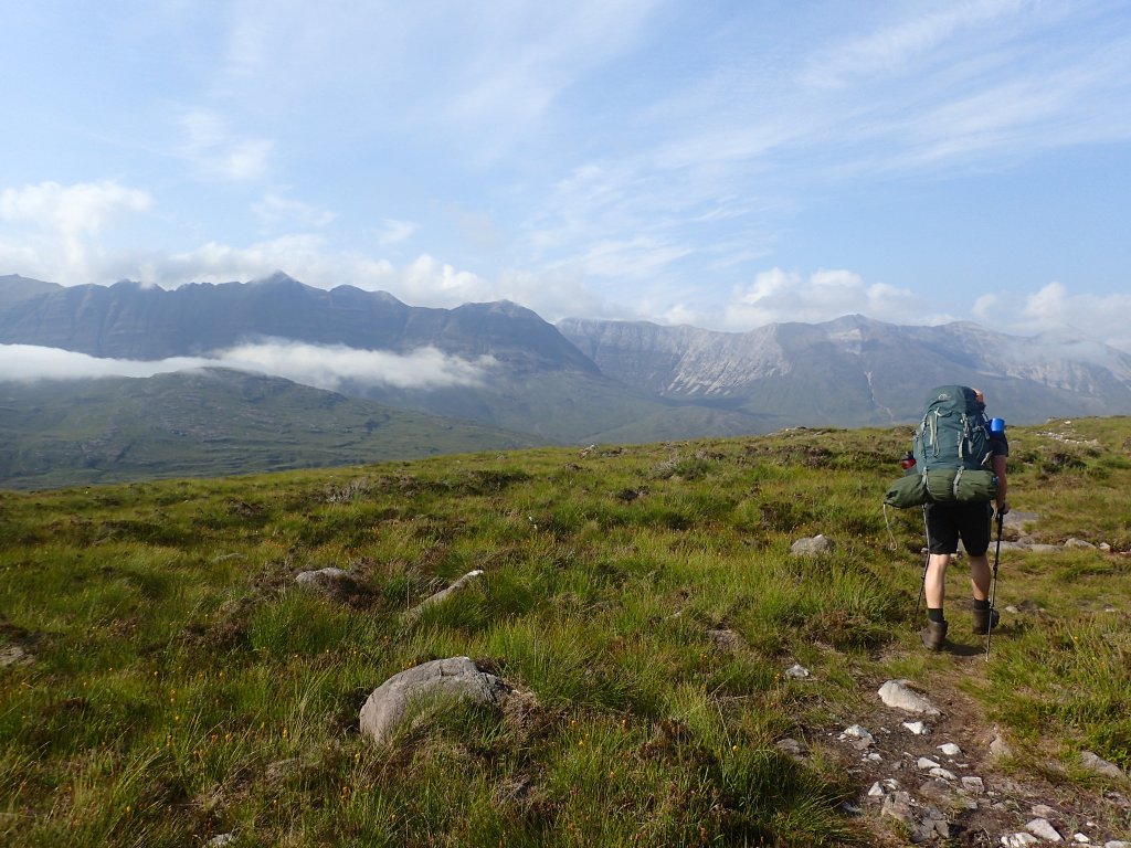
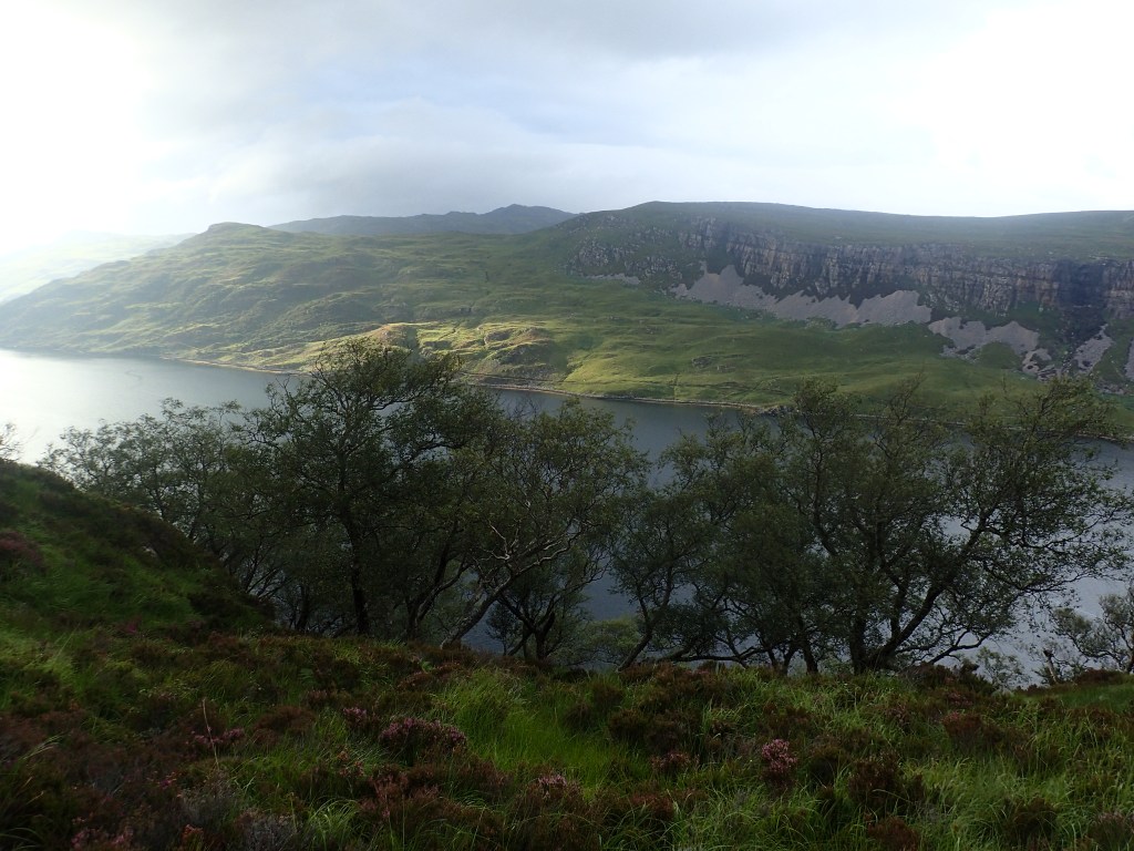
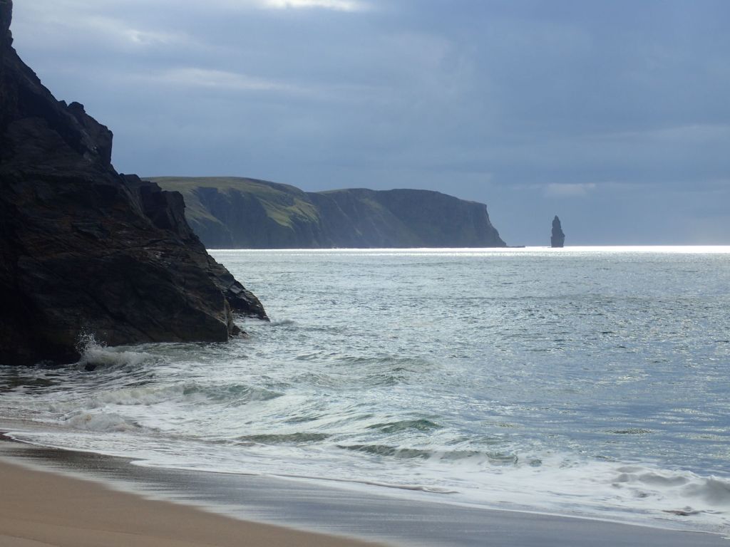
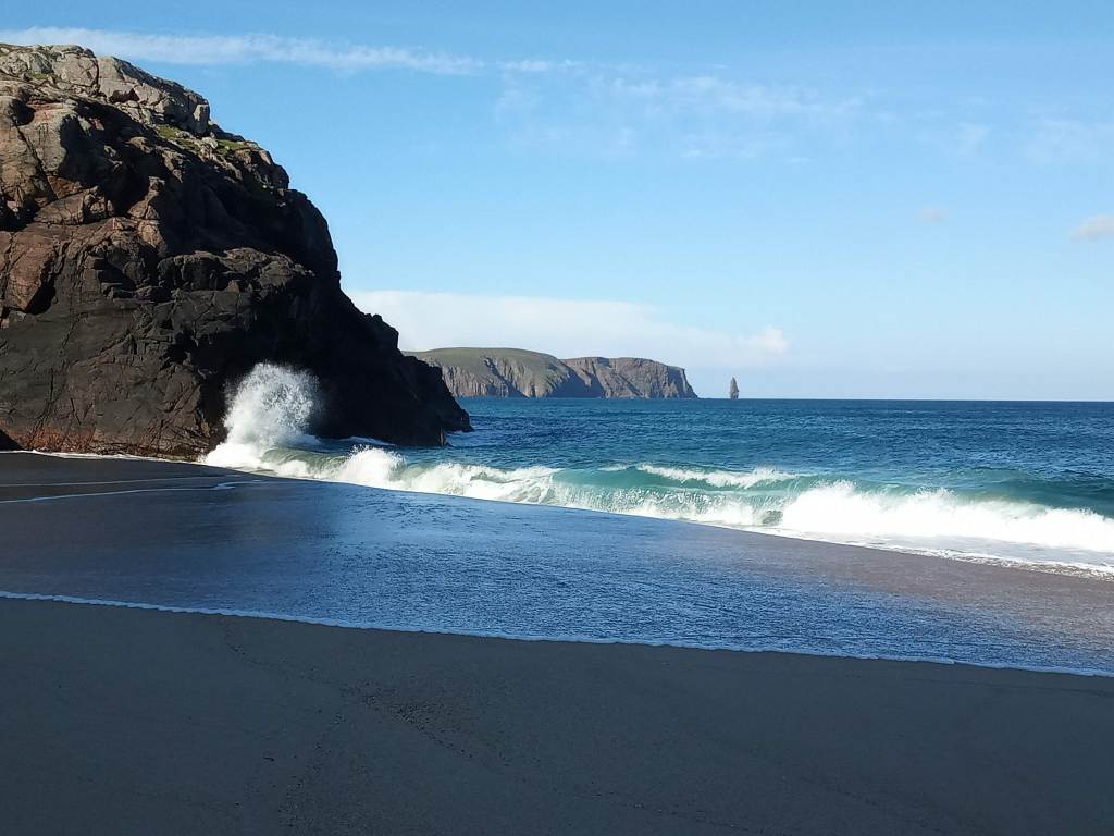
The next morning we ate as much as we could manage of a vast Scottish cooked breakfast, complete with haggis and black pudding, and continued up the single-track road towards its terminus at the hamlet of Shegra. The end was now in sight; we were less than 20 miles from Cape Wrath, and all of a sudden the completion of our quest was in reach, lending new energy to our steps. In no time at all, we had turned off the road at Oldshoremore and were marching along the path to Sandwood Bay. This remote beach, owned and managed by the John Muir Trust, lies 5 miles from the road and is framed at its southern end by an iconic sea stack, Am Buachaille (a Gaelic name meaning ‘the shepherd’). After 5 miles of bleak, rolling moorland, the dramatic sweep of the bay with its glorious sand dunes came into view, and we caught our first tantalising glimpse of Cape Wrath, wreathed in cloud on the far horizon.
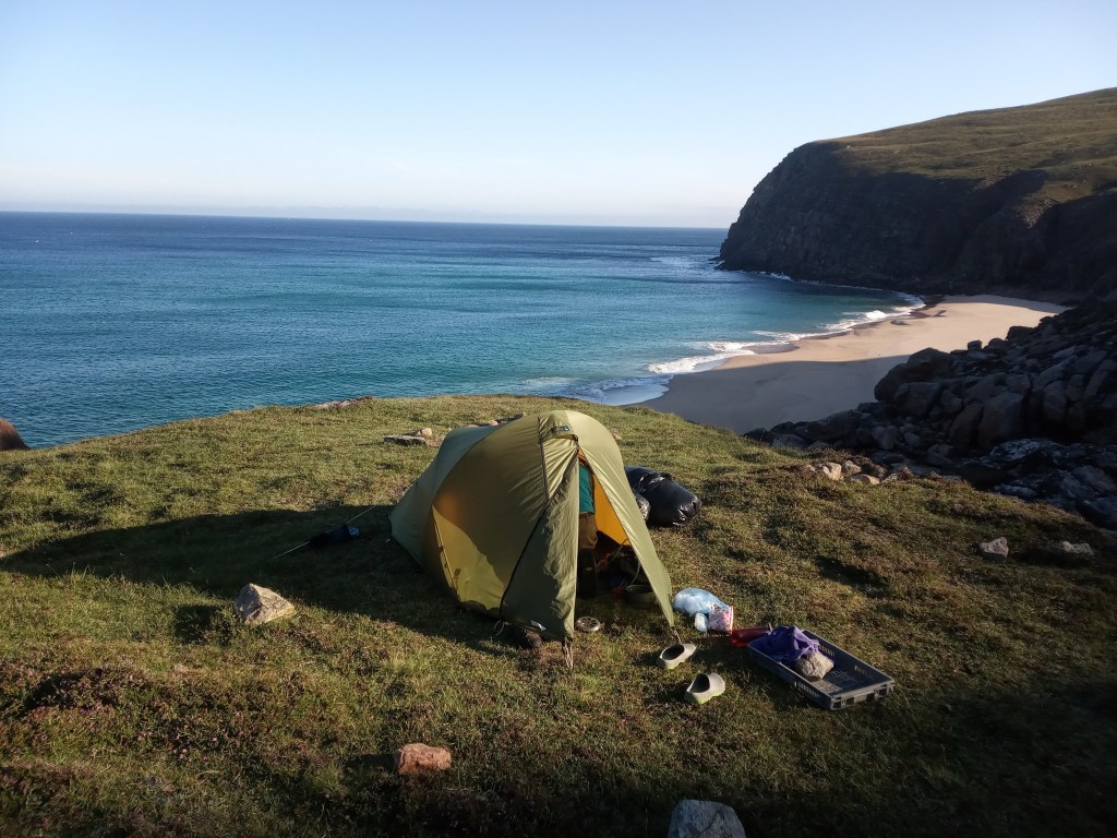
Eagerly we hurried down to the sand, where iron-grey waves crashed in from the Atlantic, and made our way up the mile-long bay towards the Cape beckoning us inexorably onwards. My parents had told us about a perfect wild camping spot on the banks of the Amhainn Srath Chailleach river, a mile or so north of Sandwood Bay, so we scrambled up a rocky bank at the northern end of the bay and made our way along the clifftops. After rambling around for a while, we found the spot: a sheltered grassy dell above the cliffs, overlooking a sandy cove, where the pure waters of the Amhainn Srath Chailleach crashed over red-gold boulders and dropped in a waterfall onto the sand below. We pitched the tent and scrambled down to the beach, where we proceeded to sprint around like children, splashing in and out of the shallows and barely able to contain our glee. We were young and free, and we had this beautiful wild place all to ourselves.
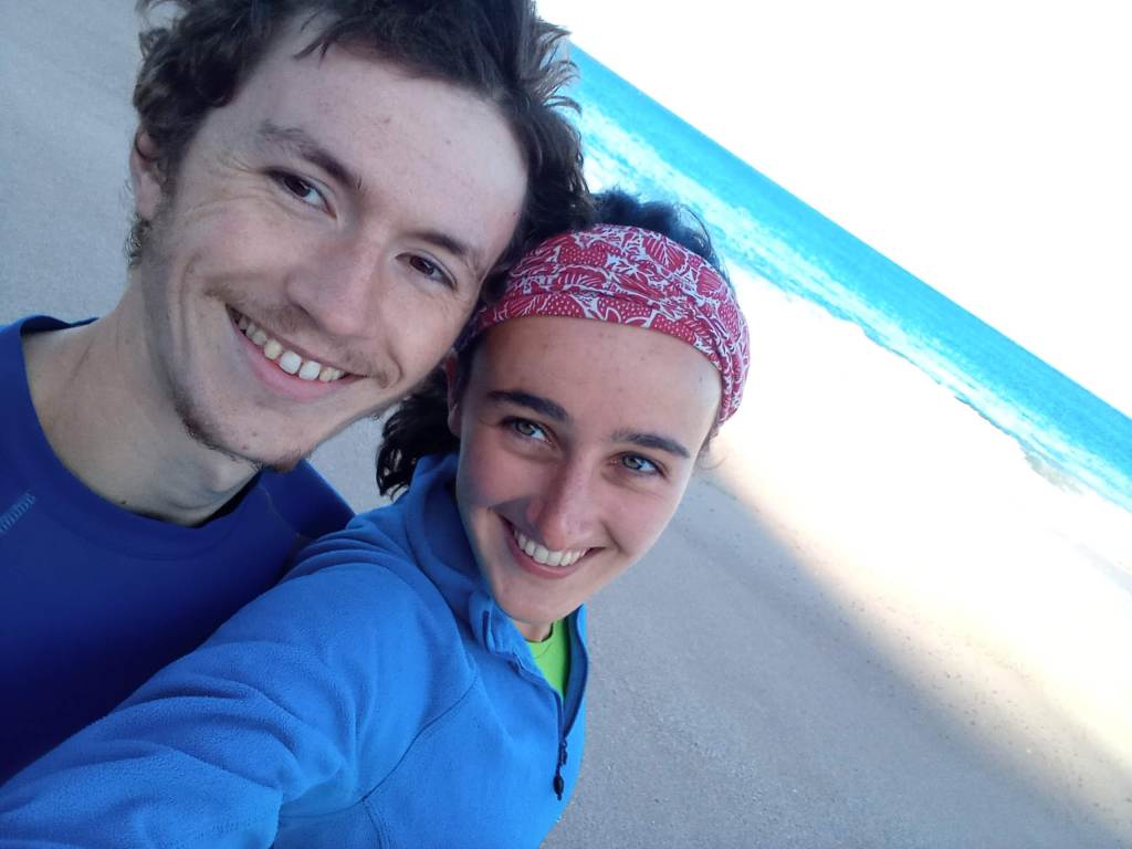
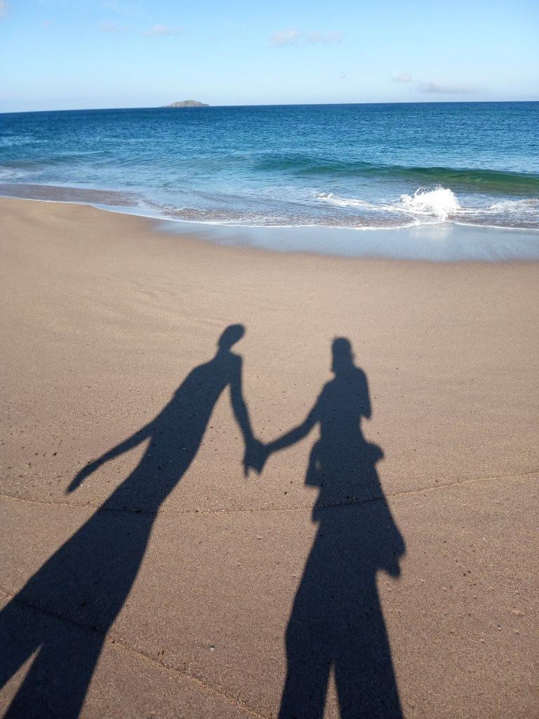
The final day of the Cape Wrath Trail dawned bright and clear. We unzipped our tent to a flawlessly blue sky and early morning sunlight illuminating the cliffs in gold. Whilst eating breakfast outside, we watched the white darts of gannets plunging into a deep blue sea. Unable to tear ourselves away from this beautiful place just yet, we headed down to the beach to stroll along the water’s edge, soaking up the light flashing off the breaking waves. Hand-in-hand with Chris, I felt almost overcome with joy to be in this place, right now, at this moment.
There were only about 6 miles to go to reach Cape Wrath. Most of it is pathless bog, traversing uninhabited tundra sometimes used by the Ministry of Defence as a live firing range. Thinking we were alone in this desolate landscape, it was therefore quite a surprise to be confronted with a cross-country runner as we set off from our campsite. He looked pretty done-in, giving us a weary wave before tramping onwards. To our astonishment, he was succeeded by not one, not two, but dozens of others, all marching purposefully through the bog, running poles flailing and knees strapped up with duct tape. Some of them looked like they were in a pretty bad way, but pushed on with an expression of dogged determination on their faces.
We soon worked out, thanks to a couple of them who had enough energy to stop and chat, that this was the final day of the Cape Wrath Trail Ultramarathon. Rather to our horror, we learned that they’d completed the grueling journey (which had taken us three weeks) in eight days. However, we were quickly assured that they had run each day with nothing more than a light daypack, thanks to a large support team that shipped everything from one camp to the next and provided them with full food and board every night. The runners we spoke to seemed astonished that we’d carried all our own gear and done it virtually unsupported, and even seemed to envy us. As one man put it, “you’ve spent three weeks enjoying the views, while I’ve spent eight days staring at my toes”.
The runners continued to overtake us as we made our way over the rolling tussock, peat and heather towards our goal. Drunk on dazzling sunlight, we relished every step, and to our surprise found ourselves wishing that the journey wasn’t coming to an end. At one point, we spotted another pair of walkers in the distance, and hurried over to talk to them, our interest piqued by the telltale enormous rucksacks. Sure enough, they were also doing the Cape Wrath Trail, but in the opposite direction, having just started their first day. How I envied them in that moment, with all those majestic landscapes ahead of them, waiting to be discovered! Half-wishing that we could go with them and do it all again, we wished them well on their journey, and went our separate ways.
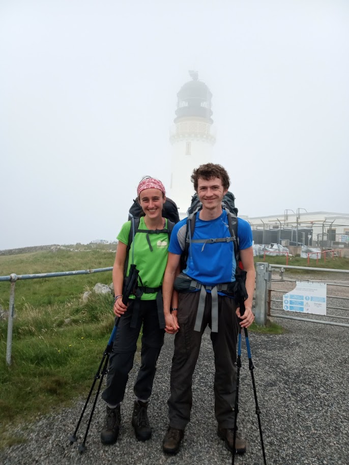
As we neared the Cape, the blue skies were covered by swirling fog. Our reluctance at ending the journey was replaced by excitement at reaching the legendary lighthouse that marks the most northwesterly point on the British mainland. And so we marched the final mile, hearts pounding with anticipation. All of a sudden, the outline of two gateposts loomed out of the mist, and as we strode up the drive towards the lighthouse, we were greeted by a wild clapping and cheering. The ultramarathon reception committee, glimpsing our figures through the fog, thought that we were another pair of runners coming in. The cheering faltered when they spotted our big rucksacks and realised their mistake, but they still cheered us in charitably as we passed underneath the finish line.
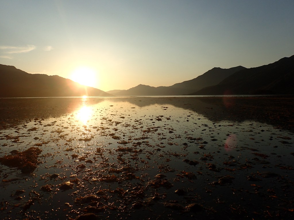
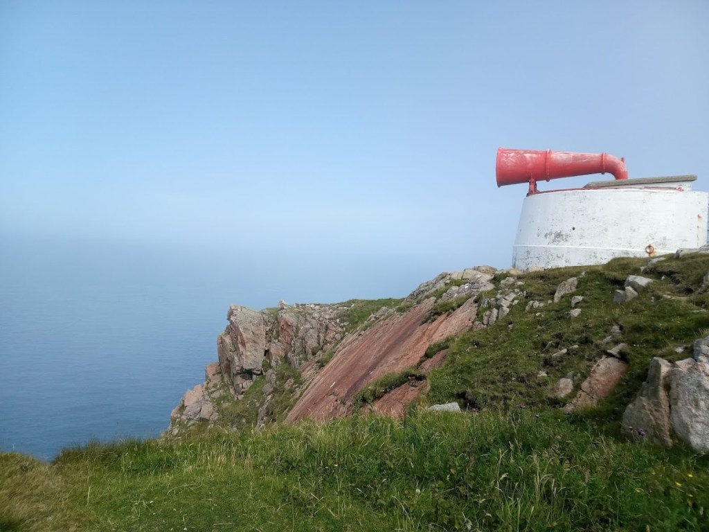
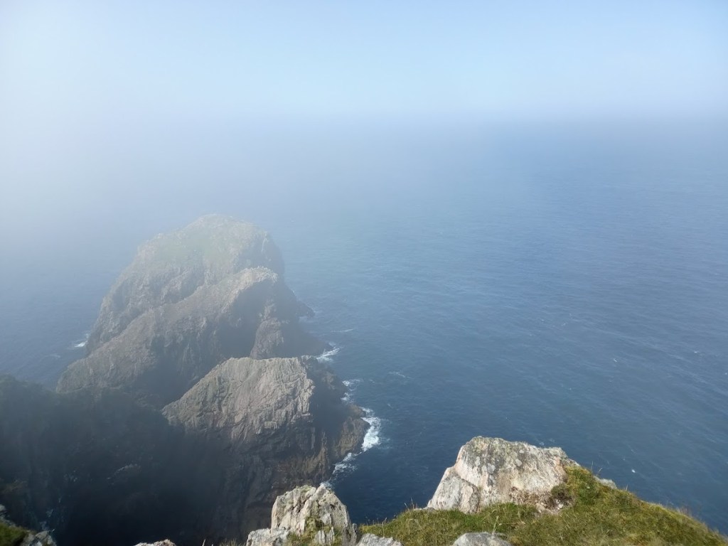
Feeling rather dazed that it was over, Chris and I spent a while chatting to the friendly support team, and some of the runners who were more with it; the official photographer even kindly took our picture. However, we needed a quiet space to savour this moment together. Leaving our bags at the Ozone Cafe where the runners were necking cold beers, we made our way past the iconic mist-wreathed lighthouse and a giant foghorn to the very edge of the cliffs, where the Atlantic crashed against rock and seabirds wheeled in great circles. At that moment, the mist lifted, revealing the vast expanse of ocean that stretched uninterrupted to the North Pole.
The name Cape Wrath comes from the Viking word hvarf, meaning “turning point”, as the headland is the point at which the Norsemen would turn their ships for home. As we sat on the cliff-edge, gazing out to sea, it was easy to imagine the Viking ships that had once navigated these waters; I could almost see them in the tossing waves. Their name for the place felt oddly fitting, all these centuries later. Casting my mind back to Sandwood Bay, through Sutherland and Assynt, down into Fisherfield and Torridon and Knoydart, all the way back to the carpark in Fort William where it all began, I realised that the Cape Wrath Trail had indeed been a turning point of sorts. It had been a greater challenge, both physically and mentally, than either of us had anticipated, but in many ways that was what had made it into such a special journey. It felt as if the lockdown-induced brain fog that had plagued me for months had finally lifted, allowing me to see clearly again. I knew that the places we’d travelled through and the people we’d met along the way would stay with me forever.
Unable to stop grinning, we turned from Cape Wrath and walked back to the lighthouse. It was time to begin the long journey home.

Very engaging and inspiring- well done, Bronwen and Chris! Having had urges to do that trail- I know recognise that I am too old to start it!!🤣🤣
LikeLike